Flood risk management
Our flood risk and drainage pages are currently under development. We will be making further changes to the information on the pages below.

Check for flooding now on GOV.UK. You can also check for Met Office weather warnings.
Under the Flood and Water Management Act 2010 (FWMA), West Berkshire Council is designated as a Lead Local Flood Authority (LLFA). We have statutory powers and responsibilities for co-ordinating flood risk management in partnership with other organisations and risk management authorities.
We work with other risk management authorities such as the Environment Agency, Thames Water and National Highways as well as the Canal and Rivers Trust, flood wardens and community groups across the district to tackle flooding issues.
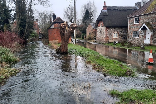
The nature of flood risk within West Berkshire is varied and widespread across the district. Incidents of groundwater flooding, river (fluvial) flooding, surface water flooding, sewer flooding and highway flooding have impacted the region both historically and in recent years. Flooding is likely to become more frequent due to climate change and increasing financial pressures on risk management authorities.
You can read a quick summary of different types of flooding and who to contact here.
West Berkshire Council understands that residents may not always be aware of the differences between the types of flooding and will place greater priority on making sure their family, friends and property are safe and secure during a flood event. Our emergency planning team work hard during flooding incidents to try and help residents where possible.
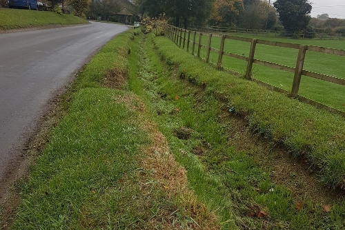
West Berkshire Council also acts as a Highway Authority under the Highways Act 1980 and has responsibilities under the Land Drainage Act 1991.
The LLFA are also a statutory consultee on major planning applications and assist the Local Planning Authority on applications where flood risk or surface water drainage is a concern.
You can find further information regarding flood risk management on the pages below:
Flooding: be prepared
Report Flooding
Highway drainage and flood risk
Types of flood risk